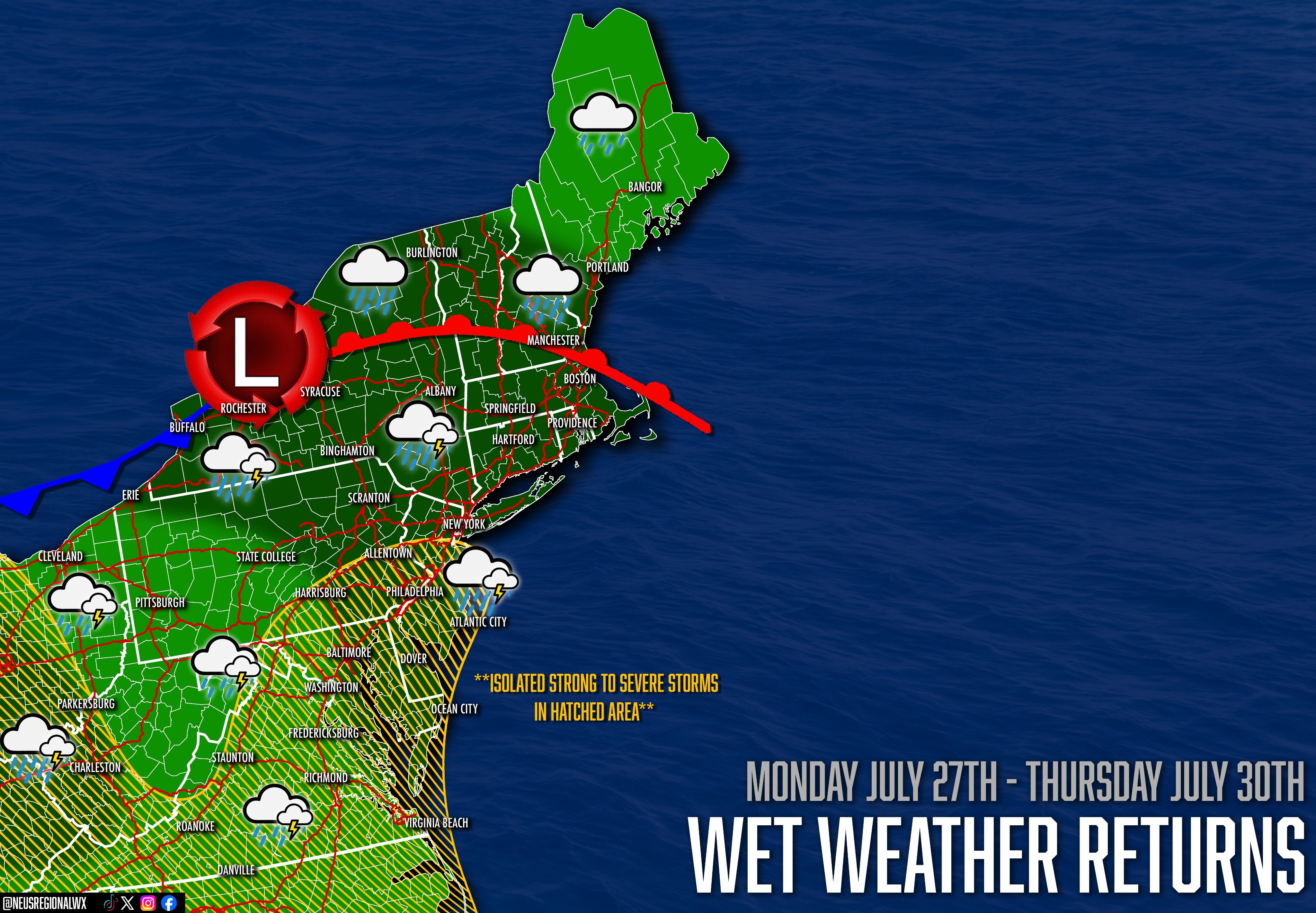
A wetter pattern is expected to return to much of the Northeast through the week. Several rounds of showers and thunderstorms may bring periods of heavy rainfall, especially where storms repeatedly track over the same areas.
A cutoff low pressure system (a system that's “cut off” from the jet stream and/or pattern flow) will impact the region beginning tomorrow night and lasting through Thursday. This will eventually develop into a Nor'Easter by Wednesday, something very uncommon for this time of year.
This system will likely bring heavy rainfall (2–4+ inches), with upwards of 6 inches in spots that encounter training thunderstorms, especially across Eastern Pennsylvania, New Jersey, Delaware, and the New York City region on Tuesday, with the threat shifting into New England on Wednesday.
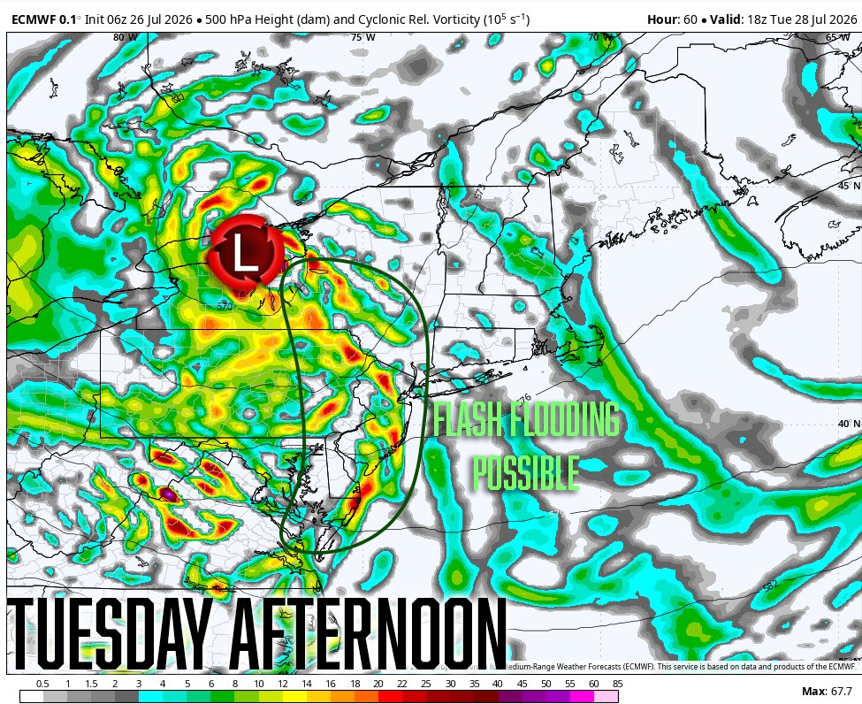
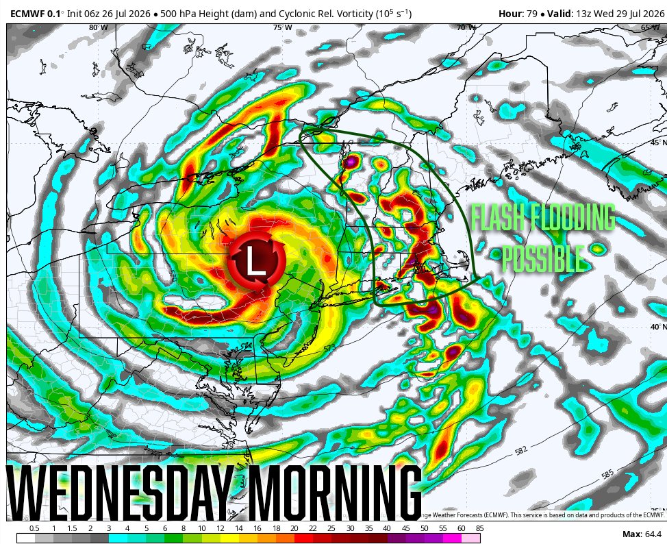
With heavy rain, the main concern will be flash flooding, although some isolated strong to severe thunderstorms are possible in southern zones, especially across Virginia and the Delmarva. Given low instability and the lack of vertical wind shear, this risk remains low.
Be sure to monitor your local weather forecasts, including us at Northeast Regional Weather, for any updates regarding this week's weather. Keep YOUR EYES to the skies.